Archives
• Search for multiple words by separating them with a single space. Searching for Rocky Pine Ranch will return records that contain Rocky OR Pine OR Ranch or any combination of the three.
• Use an asterisk (*) as a wildcard.
• To search by phrase, wrap your criteria in quotes, e.g. “Rocky Pine Ranch”
• Using AND / OR / NOT connections between words allows you to limit or expand your search criteria.
• You can combine connectors for more specific results by using parenthesis in your search string. As an example, rock OR (pine AND ranch) will return different results than (rock OR pine) AND ranch.
1205 results found sorted by relevance. Records searched: 1205
-
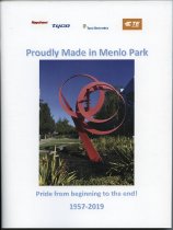
Proudly Made in Menlo Park - Yearbook
Proudly Made in Menlo Park, June 2019. Commemorative yearbook-style booklet prepared by Gwen Dossey for the employees of Tyco. The booklet was produced for the closing of the last work site in the Menlo Park complex of Raychem and later Tyco (Tyco Electronics, TE Connectivity).
Record Type: Archive
-
Gordon Joinville - A City of San Mateo Fallen Hero - Manuscript
Gordon Joinville - A City of San Mateo Fallen Hero, 2009. Manuscript written by Robert Leuten on Gordon R. Joinville. At the time of writing, Joinville was the only City of San Mateo police officer to have been killed in the line of duty. The text is divided into four parts: Officer Down; The Aftermath; A Friend of Youth; The Legacy. 15 pages with color illustrations.
Record Type: Archive
-
Historic Resources Evaluation Report for 1007 East 5th Avenue, San Mateo, CA 94402 - Report
Historic Resources Evaluation Report for 1007 East 5th Avenue, San Mateo, CA 94402, October 2018. Report prepared for Laura Watanuki by Denise Bradley (Landscape Historian) and Ward Hill (Architectural Historian). The report includes a description of the house, site history, historical contexts, and evaluation as a Historic Resource. Includes appendices with 10 illustrations and 59 photographs.
Record Type: Archive
-
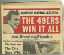
Super Bowl Extra - Newspaper
Super Bowl Extra edition of the San Francisco Chronicle from January 25, 1982. Features the 49ers with Joe Montana on the front page.
Record Type: Archive
-
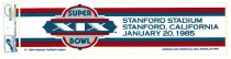
Super Bowl XIX - Sticker, Bumper
Super Bowl XIX bumper stickers, 1985. Four Super Bowl XIX bumper stickers on original backing. Printed in red and blue on a white background. The design shows a super bowl logo left of center against a striped border at top and bottom. Text within the border at right reads, "STANFORD STADIUM / STANFORD, CALIFORNIA / JANUARY 20, 1985." Original sale price sticker is 69 cents.
Record Type: Archive
-
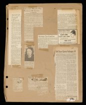
Peninsula Art Association Scrapbook - Archive
Peninsula Art Association Scrapbook, 1949-1957. Contents includes: documents, newsletters, black and white photographs, newspaper articles, Articles of Incorporation and By-laws of the Peninsula Art Association. 104 pages.
Record Type: Archive
-
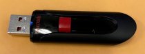
USB Drive of Photos from Rognier Scrapbook - Drive, Data
USB Drive of Photos from Rognier Scrapbook. Contains digital photos 2020.004.002.1-31. Black USB SunDisk Drive with red retracter knob that controls the USB head.
Record Type: Archive
-
04-SM-101-9.6; Ralston Ave. Interchange in Belmont - Document File
04-SM-101-9.6; Ralston Ave. Interchange in Belmont, 1968-1969. Right of way acquisition documents for parcels of land in San Mateo County. This file concerns one parcel needed for the Ralston Avenue and Highway 101 interchange in anticipation of the July 4, 1968 opening of Marine World.
Record Type: Archive

-
IV-SM-55,56,D1C,A,E - Jct. of Routes 55 and 56 at Thornton to Edgemar - Document File
IV-SM-55,56,D1C,A,E - Jct. of Routes 55 and 56 at Thornton to Edgemar, 1953-1955. Right of way acquisition documents for parcels of land in San Mateo County. The file contains information on the Henry Doelger development project that became Westlake in Daly City. Properties listed were needed for "widening and realignment" of Skyline Boulevard from Alemany Boulevard (today's John Daly Boulevard) to Edgemar Avenue in today's Pacifica. Photographs ...
Record Type: Archive

-
IV-SM-68-RdwC,C,D,MlP; 0.2 Miles South of Bransten Road (0.07 Scar) to Santa Clara County Line (mi. 0.00D) Length 7.1 Miles - Document File
IV-SM-68-RdwC,C,D,MlP; 0.2 Miles South of Bransten Road (0.07 Scar) to Santa Clara County Line (mi. 0.00D) Length 7.1 Miles, 1953. Right of way acquisition documents for parcels of land in San Mateo County. This file includes 23 parcels of land between Belle Avenue and Fifth Avenue needed for the development of Bayshore Highway in East Palo Alto.
Record Type: Archive

-
IV-SM-68-SM, C, Bmt, Scar, RdwC, D, Mlp - Peninsular Ave in SM (mi 1.91SM) to So County Boundary (mi 0.00D) - Document File
IV-SM-68-SM, C, Bmt, Scar, RdwC, D, Mlp - Peninsular Ave in SM (mi 1.91SM) to So County Boundary (mi 0.00D), 1955-1956. Right of way acquisition documents for parcels of land in San Mateo County. This file shows 21 properties on both sides of University Avenue required for the proposed University Avenue Interchange in East Palo Alto. Properties include a trailer court, houses, bars, a motel, stores, gas stations, a restaurant, and a real estate o...
Record Type: Archive

-
IV-SM-68-SM-C,Bmt,Scar,RedwC,D,MLP; Peninsular Ave. in SM (Mi. 1.91 SM) to So. County Boundary (Mi. 0.00 D) - Document File
IV-SM-68-SM-C,Bmt,Scar,RedwC,D,MLP; Peninsular Ave. in SM (Mi. 1.91 SM) to So. County Boundary (Mi. 0.00 D), 1955-1956. Right of way acquisition documents for parcels of land in San Mateo County. This file contains appraisals for 21 parcels needed for the University Avenue interchange and the Bayshore Freeway project between University Avenue and Willow Road in East Palo Alto.
Record Type: Archive

-
IV-SM-68-SM, C, Bmt, SCar, RdwC, D, M1P - Peninsular Ave. in SM (Mi. 1.91SM) to So. County Boundary (Mi. 0.00D) - Document File
IV-SM-68-SM, C, Bmt, SCar, RdwC, D, M1P - Peninsular Ave. in SM (Mi. 1.91SM) to So. County Boundary (Mi. 0.00D), 1955. Right of way acquisition documents for parcels of land in San Mateo County. This file shows four parcels necessary for the Bayshore Highway improvement project in East Palo Alto.
Record Type: Archive

-
IV-SM-68-SM,C,Bmt,Scar,RdwC,D,Mlp; Peninsular Ave. in SM (Mi. 1.91 SM) to So. County Boundary (Mi. 0.00D) - Document File
IV-SM-68-SM,C,Bmt,Scar,RdwC,D,Mlp; Peninsular Ave. in SM (Mi. 1.91 SM) to So. County Boundary (Mi. 0.00D), 1956. Right of way acquisition documents for parcels of land in San Mateo County. This file concerns two parcels needed for the Bayshore Freeway project between Redwood City and the south County boundary.
Record Type: Archive

-
04-SM-92-7.2-14.2 - South Norfolk Street to Toll Plaza, Hayward-San Mateo Bridge - Document File
04-SM-92-7.2-14.2 - South Norfolk Street to Toll Plaza, Hayward-San Mateo Bridge, 1965. Right of way acquisition documents for parcels of land in San Mateo County. This file includes historical background on the beginnings of Foster City. Appraised parcels belong to T. Jack Foster and Sons with the exception of one owned by the Henry Mitvalsky Estate. The properties were needed to create a bridge and roadway from South Norfolk Street in San Mateo...
Record Type: Archive

-
IV-SM-56,105-C,A; Tunitas Creek to 2 1/2 Miles North of Half Moon Bay. - Document File
IV-SM-56,105-C,A; Tunitas Creek to 2 1/2 Miles North of Half Moon Bay, 1953. Right of way acquisition documents for parcels of land in San Mateo County. This file contains 11 parcels needed to widen Highway 1, shifting the highway to the west. The appraisals evaluate empty lots, a few houses, farm buildings, and other improvements.
Record Type: Archive

-
IV-SM-55,56-DlC,A,E; Junction of Rte. 55 & 56 (MI.0.95-55 DLC) to Edgemar (MI.3.50-56-E). - Document File
IV-SM-55,56-DlC,A,E; Junction of Rte. 55 & 56 (MI.0.95-55 DLC) to Edgemar (MI.3.50-56-E), 1954-1956. Right of way acquisition documents for parcels of land in San Mateo County. This file concerns 17 undeveloped parcels needed to link the future Highway 1 with Skyline Boulevard in Pacifica.
Record Type: Archive

-
04-SM-1-34.6-40.6; 0.7 mi. south of San Vicente Crk to 0.2 mi. south of San Pedro Creek in Pacifica. - Document File
04-SM-1-34.6-40.6; 0.7 mi. south of San Vicente Crk to 0.2 mi. south of San Pedro Creek in Pacifica, 1970-1975. Right of way acquisition documents for parcels of land in San Mateo County. This file concerns 11 parcels (nine full and two partial takes) needed for the construction of Highway 1 through the unincorporated area of Montara and Pacifica.
Record Type: Archive

-
04-SM-1-34.6-40.6; 0.7 mi. S. of San Vicente Crk to 0.2mi. S. of San Pedro Crk in Pacifica - Document File
04-SM-1-34.6-40.6; 0.7 mi. S. of San Vicente Crk to 0.2mi. S. of San Pedro Crk in Pacifica, 1970. Right of way acquisition documents for one parcel of land in San Mateo County to connect Half Moon Bay and Pacifica via Highway 1.
Record Type: Archive

-
04-SM-1-34.6-40.6; 0.7 mi. south of San Vicente Crk to 0.2 mi. south of San Pedro Creek in Pacifica. - Document File
04-SM-1-34.6-40.6; 0.7 mi. south of San Vicente Crk to 0.2 mi. south of San Pedro Creek in Pacifica, 1970-1973. Right of way acquisition documents for parcels of land in San Mateo County. This file shows five parcels needed for the construction of Highway 1 in Pacifica.
Record Type: Archive

-
04-SM-186-X6.3-X6.9 - 0.2 Mile East of Route 280(239) to Route 82(2) in San Bruno. - Document File
04-SM-186-X6.3-X6.9 - 0.2 Mile East of Route 280(239) to Route 82(2) in San Bruno, 1965-1967. Right of way acquisition documents for parcels of land in San Mateo County. This file is concerned with building Route 186 (later I-380) through the naval base at San Bruno. Maps and photographs show the extent of the base, which ran along El Camino Real from Sneath Lane to San Bruno Avenue. The base was across the street from "the former Tanforan Race T...
Record Type: Archive

-
04-SM-35-23.4-28.3 - 0.4 Mile North Route 280 near Crystal Springs Road to 0.3 mile South of Route 1 - Document File
04-SM-35-23.4-28.3 - 0.4 Mile North Route 280 near Crystal Springs Road to 0.3 mile South of Route 1, 1966. Right of way acquisition documents for parcels of land in San Mateo County. This file concerns two parcels of unimproved land at the northwest corner of Sneath Lane and Skyline Boulevard (CA-35). The "General Information" section describes residential development in western San Bruno. A photograph shows the intersection where a service stat...
Record Type: Archive

-
04-SM-280-20.4X-22.7X, 0.4 Mi. S. of San Bruno Ave. to 0.2 Mi. S. of Arroyo Dr. - Document File
04-SM-280-20.4X-22.7X, 0.4 Mi. S. of San Bruno Ave. to 0.2 Mi. S. of Arroyo Dr., 1966-1967. Right of way acquisition documents for parcels of land in San Mateo County. This Supplemental Appraisal Report shows undeveloped land needed for construction of I-280 in San Bruno.
Record Type: Archive

-
04-SM-186-6.9-7.6 Route 82 to Route 101 - Document File
04-SM-186-6.9-7.6 Route 82 to Route 101, 1967. Right of way acquisition documents for parcels of land in San Mateo County. This file shows one parcel for the I-380 and Highway 101 interchange in San Bruno on the 900 block of 6th Avenue.
Record Type: Archive

-
04-SM-380-X6.9-X7.6 Route 82 to Route 101. - Document File
04-SM-380-X6.9-X7.6 Route 82 to Route 101, 1968-1970. Right of way acquisition documents for parcels of land in San Mateo County. This file contains one parcel at 1009 San Mateo Avenue needed for the construction of I-380.
Record Type: Archive