
Archive Record
Images
Metadata
Title |
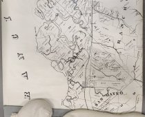
Untitled [San Mateo to San Francisquito Creek] |
Object Name |
Map |
Scope & Content |
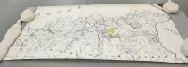
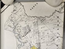
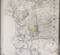
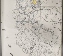
Untitled [San Mateo to San Francisquito Creek], 20th century. Partial section of the 1868 Official Map of the County of San Mateo reprinted with blank ink on white paper. Map shows San Mateo at north to San Francisquito Creek at south with tract boundaries and ownership. The map includes some hand coloring and notations handwritten in blue ink to show waterways, etc. Dimensions: 24" x 45.875" |
Date |
20th century |
Creator |
Unknown |
Catalog Number |
2022.048.002 |
Extent of Description |
23.75" x 42.5" |
Collection |
Archival - Maps |
Search Terms |
Belmont Land Use Menlo Park Redwood City San Carlos San Mateo |
Subjects |
Land subdivision Land use San Mateo County (Calif.)--Maps |
Credit line |
Courtesy of the Seely Family |